


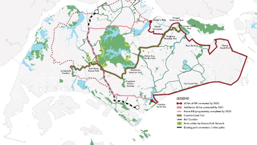
Walking the NParks 36km Coast-to-Coast trail: Worth the effort?
What is it like to walk along the new Coast-to-Coast trail? CNA's Darius Boey took a leisurely two days to experience the sights, sounds and smells of the 36-kilometre route linking Jurong Lake and Coney Island.

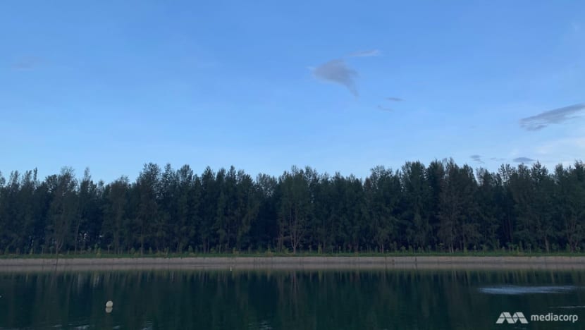
Part of the new 36km Coast-to-Coast Trail, the journey from Chinese Garden to Coney Island took about a day-and-a-half. (Photo: Alif Amsyar)


SINGAPORE: If you want the chance to really stretch your legs in Singapore, the new 36-kilometre Coast-to-Coast (C2C) Trail could be just what you're looking for.
Launched by NParks last week, the trail links Jurong Lake with Coney Island, taking in a variety of parks and nature areas along the way.
But what is it like to undertake this long walk? Beautiful or boring? Tiring or terrific? I was given the job of road-testing the trail to help you decide if putting in the hard effort is worth it.
For such a long walk, preparation is key. I gathered a hydration pack with a 2-litre capacity and three granola bars. My pack also included a cap, batteries for my GoPro and an extra water bottle. With that (and a good night’s sleep), I was ready.
THE BEGINNING: 7.3KM FROM CHINESE GARDEN TO BUKIT BATOK NATURE PARK
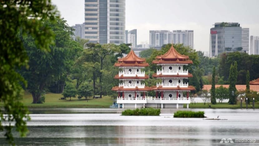
I began the journey at Chinese Garden at 10am, with my original plan of leaving at 7am being scrapped by an early morning thunderstorm. As I walked my first trail steps, the beautiful twin pagodas on Jurong Lake created a pleasing view amid all the construction, with their tangerine tiling and white concrete walls standing out from the greenery.
From the relative peace and quiet of Jurong Lake, I made my way to the busy metropolis of Jurong East.
Being a multi-line MRT and bus interchange, Jurong East was buzzing with action and people. It was far-removed from being a charming nature spot, but walking through the area as a sightseer rather than a busy commuter allowed me to experience its charms in a different way.
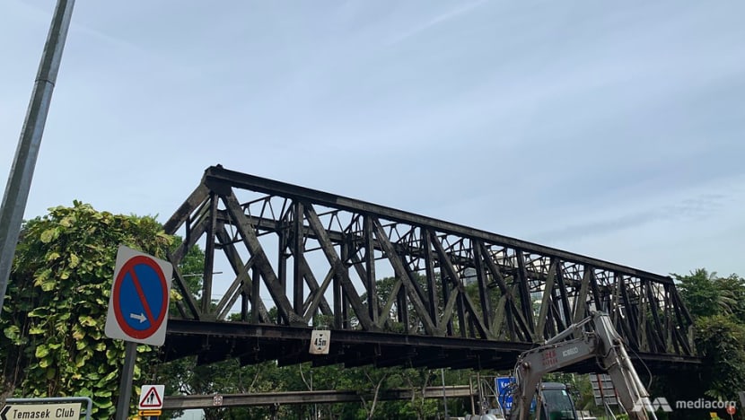
Proceeding on to Bukit Batok Nature Park, I went through several highway underpasses. These underbellies of Singapore were mostly damp and dark, with few signs of life except a few pigeons who seemed to eye me with suspicion as if they felt I was intruding on their territory.
Traffic rumbled overhead, loud enough to occasionally startle the pigeons into life before settling again.
After the urban sprawl of Jurong East, Bukit Batok Nature Park was a pleasant contrast.
I was greeted by the sight of tall, slender trees with roosters crowing a cheery welcome. However, following the NParks C2C app meant that I had to go around the park instead of through it to get to my checkpoint: Beauty World.
Reaching Beauty World at around 1pm, there was one thing on my mind: Lunch. I decided to take a pit-stop at the nearby eatery Al Azhar, before carrying on.
CARRYING ON: 7.4KM FROM BEAUTY WORLD TO MACRITCHIE RESERVOIR
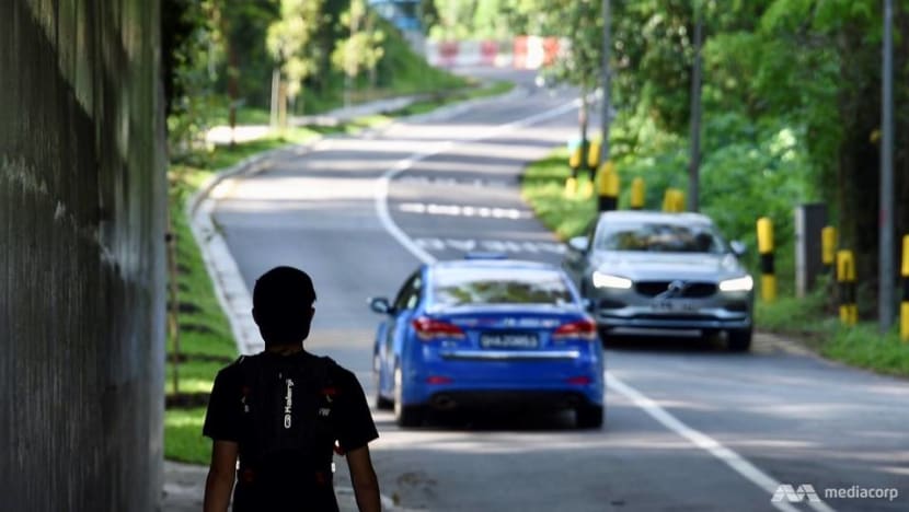
As the day wore on, the grey clouds and damp air changed into clear blue skies and a scorching hot environment. Not the most pleasant walking conditions on those stretches of the trail with little shade and not much to see.
Still, I powered on.
The path from Botanic Gardens to MacRitchie was more or less a straightforward 7.4km march stretching into central Singapore.
Compared with the early part of the trail, the trip from Beauty World to MacRitchie did not hold much appeal, with long, hot stretches of road, old-fashioned tyre sellers and nondescript semi-detached houses.
However, things changed about 3km away from the reservoir when I reached Bukit Brown Cemetery. All of a sudden, the trail went quiet and not a single car passed by. Even at 5pm in the afternoon, the atmosphere was a little eerie.
As it was edging close to sundown, I trotted along.
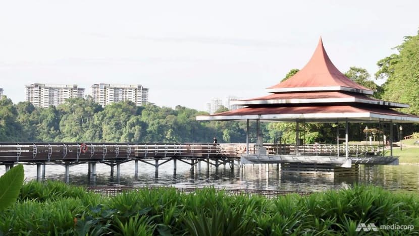
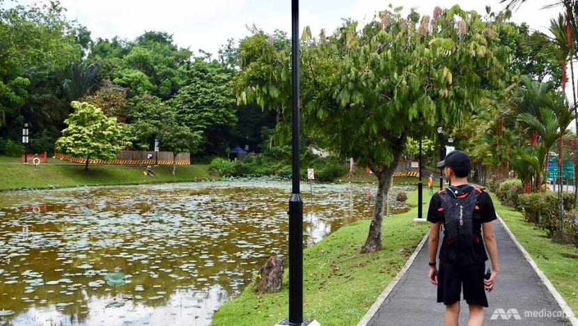
The trail started to get a little more attractive as I approached MacRitchie Reservoir. Along with its captivating views, MacRitchie offered some wildlife to keep me company, with frolicking monkeys and colourful birds.
There were lots of people enjoying the reservoir too. There were canoeists in bright orange vests paddling furiously in red canoes, shouting “left, right, left” as they powered through the dark, green water.
Families had also gathered for picnics, despite it being a weekday. Toddlers played on the grass while parents and grandparents enjoyed their food in the cooler late afternoon air.
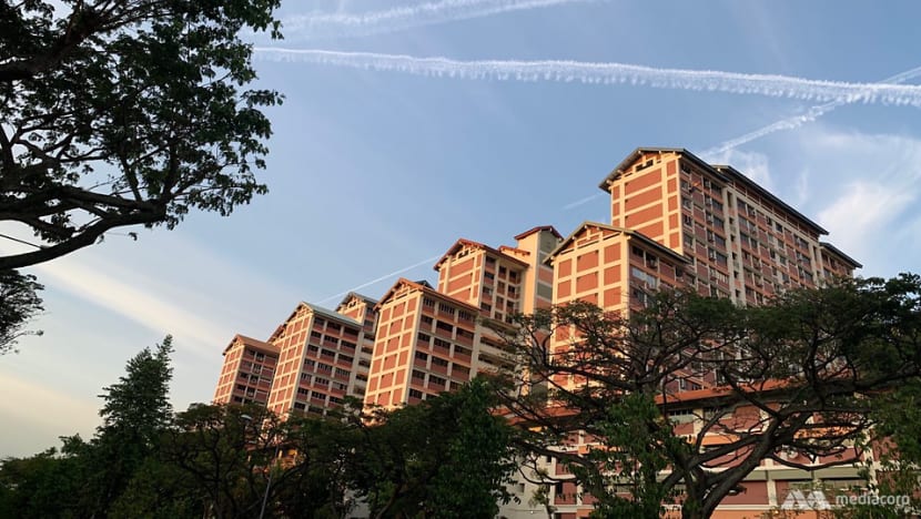
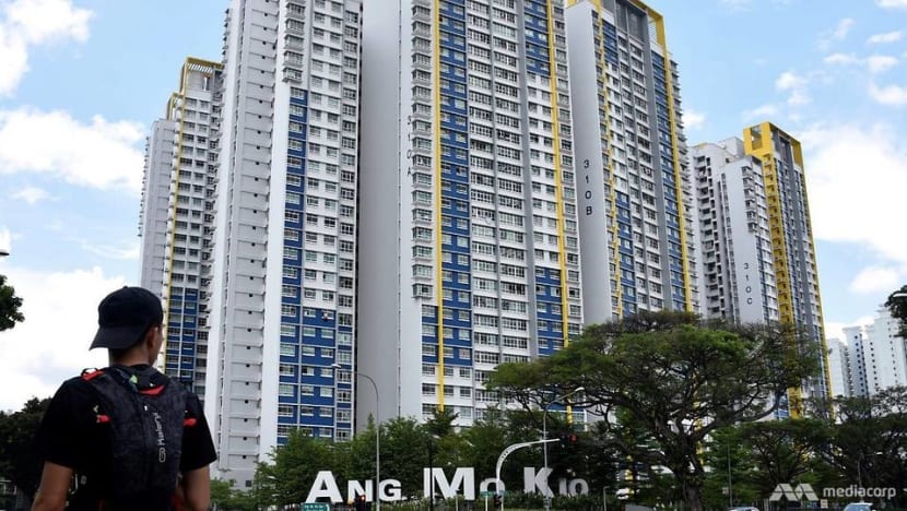
After the beautiful views at MacRitchie, I proceeded on to Bishan-Ang Mo Kio Park. By then, the buildings along Bishan were being given a soft glow from the evening sun. This was a pleasing contrast to the crowded roads, where peak hour traffic was creating a constant din.
The stretch to my next destination was a lengthy one, and by the time I reached it, it was about 7pm. With about another 15km to go to complete the trail, I decided to continue the next day.
DAY 2: PICKING UP WHERE WE LEFT OFF
The next day, I returned to Bishan-Ang Mo Kio Park at 12.40pm, giving myself the afternoon to finish the trail.
For this stretch, I was heading to Sengkang. Along the path, it was much hotter than the day before. With the sun beating down, walking conditions were not pleasant.
Ang Mo Kio seemed huge. Even after walking for an hour-and-a-half, through the nearby Town Garden and Linear Park, I still found myself within its sprawl and was beginning to question whether I was lost. Then suddenly I reached Sengkang Riverside Park and I knew I was still on the right track.
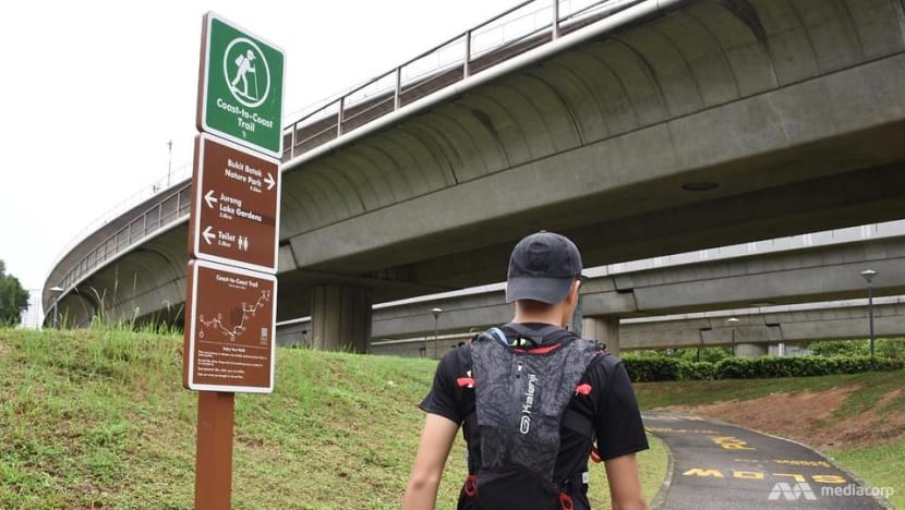
And at that moment, I realised how important the NParks C2C app was to complete the trail, as there were tricky stretches when the guiding posters were quite far apart from each other. But as helpful as it was, there were some moments when I got a little lost because of the App’s limited navigation features.
But to those who want to give this trail a try, I would suggest downloading it as it at least points you broadly in the right direction.
THE LAST STRETCH TO CONEY ISLAND
Back to Sengkang, and its Riverside Park provided a great view of Sungei Punggol, with emerald green water guiding me through the northeast of Singapore.
After walking through the tranquil greenery by the river for quite some time, signs of another neighbourhood started to appear, with highways, grey and white high-rise buildings, and LRT tracks popping up as I walked.
Not long after, the pathway from Riverside Park connected me to beautiful Punggol Waterway Park. In comparison to the other parks, this offers visitors larger, more open space. The bridges, wide expanses of water and play areas made it very appealing.
With a stream in the middle that runs through the entire park, coupled with a stunning view of the Singaporean skyline, the park was a highlight of the trail.
At that point in time, I hurriedly picked up the pace, as it was about 6pm and also because I was less than 2km away from the trail’s final destination: Coney Island. I wanted to get there before sunset.
Its tall and slender trees stood on the horizon, with calm seawater separating it from Waterway Park.
I continued on for the final 400m. Cyclists and runners went by, blasting workout music as they got on with their lives. And for me, it was good to reach the green gates of Coney Island.
I had finished the trail.
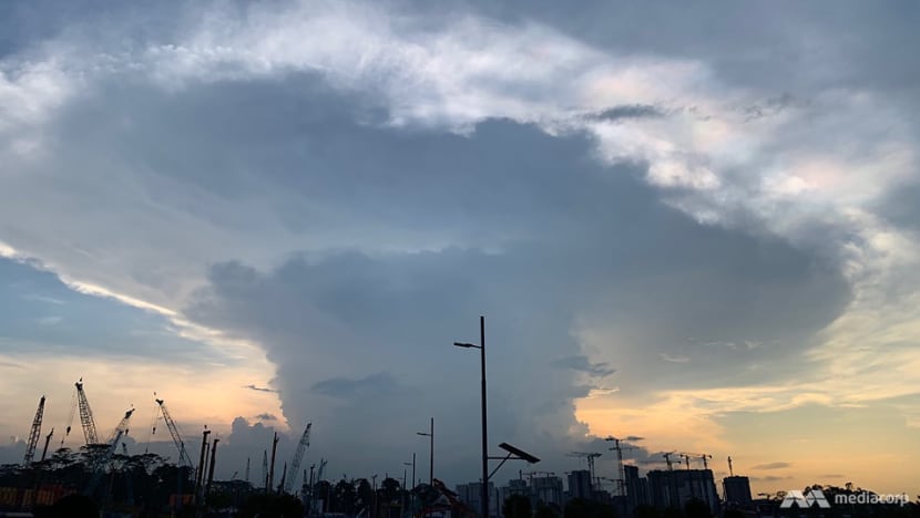
With the sun setting in the background, I was pleased to have completed the 36km walk across Singapore. While some stretches were definitely much nicer than others, overall the hike was worth it.
I saw some parts of Singapore I had never visited before. And for those areas I was more familiar with, experiencing them as a hiker rather than a commuter or shopper let me see them in a fresh light.
The sweat and sore legs were a small price to pay.

