


Fending off the floods – 5 things to know about polders and how they could work in Singapore
With polders being looked at as a way for Singapore to cope with rising sea levels, CNA went to the Netherlands - which is the global leader in the technology - to find out how they work.

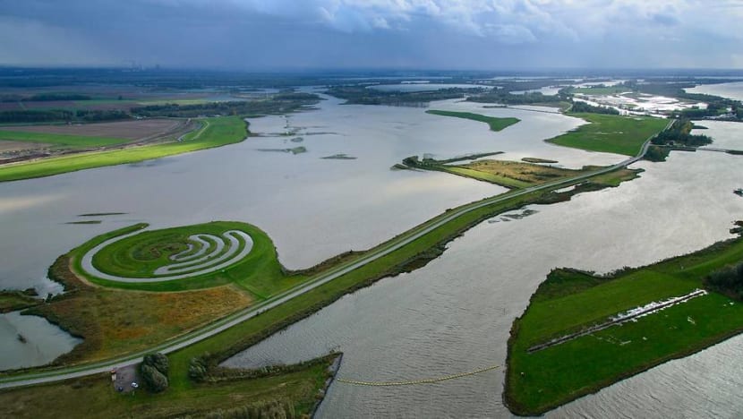
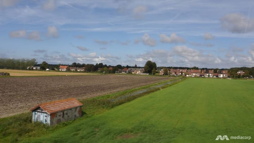
A polder in the south of the Netherlands. Polders are a uniquely Dutch term referring to reclaimed land that lies below sea level. (Photo: Dutch Ministry of Infrastructure and Water Management)


DELFT/NIJMEGEN, Netherlands: “If I show you around, you won’t be aware that you are in a polder area,” said Tjitte Nauta from Dutch research institute Deltares.
Turning to me, he continued: “Where you sit is 3 metres below sea level.”
While they be unfamiliar to many, polders are a crucial part of the Dutch landscape - a key defence in the European country’s centuries-long battle against water.
READ: Tides of change - Amid rising sea levels, the Dutch float new initiatives with farms and more homes on water
READ: Tides of change - From fighting against the seas to living with it - How the Netherlands kept itself dry
By building dykes alongside a network of drainage canals and water pumps, the Netherlands, which literally translates to “low lands”, has turned its flood-prone areas into usable land that is suitable for tens of millions of people to live, work and play.
One example is where Deltares’ headquarters is located.
The polder, one of thousands across the country, was previously a vast swathe of swamps, according to Mr Nauta.
This Dutch model of polders is now a “serious option” for Singapore’s eastern coastline, Prime Minister Lee Hsien Loong said at his National Day Rally speech last month.
Already, a small polder is being built at Pulau Tekong to gain some experience. The new land will be used for military training, added Mr Lee.
So how do polders work and how different are they from the typical reclamation method?
READ: NDR 2019: It could cost S$100 billion or more to protect Singapore against rising sea levels, PM Lee says
READ: New reclamation method aims to reduce Singapore's reliance on sand
1. WHAT ARE POLDERS?
Polders are tracts of land that lie below sea level and are reclaimed from the ocean, lakes, rivers or wetlands through the building of dykes, drainage canals and pumping stations, according to Dutch experts that CNA spoke to.
“Polders are land reclamations, but not all land reclamations are polders. When the level of the land is higher than sea level and no pumping is required, there is no polder,” said Associate Professor Mick van der Wegen from the IHE Delft Institute for Water Education.
Hence a key feature of polders, according to Mr Nauta from Deltares, is that they are “hydrologically separated” from their surroundings.
“This means you can control the water within a polder through pumping stations usually.”
It works like this: The submerged area is first enclosed, or sometimes partially, by a dyke to keep water out. Water from within is then drained, creating a polder – dry land that is lower than sea level.
A polder is kept dry by an extensive grid of canals – from small drains to big canals with sluice gates to control water flow – and pumps. Retention areas may be created to store water in case of emergencies.
“Excess water will flow over land if you don’t create space so you will always see canals in polders. From there, we will pump it out,” said Mr Mark van Zanten, a senior project manager at Dutch engineering consultancy firm Royal HaskoningDHV, who is involved in the polder development on Pulau Tekong.
While the most iconic images of the Dutch landscape usually show polders as rectangular plots of flat land, they can come in other shapes and have various heights – still below sea level.
These height variations can be naturally-occurring from sea or river beds. They can also be man-made, when sand is added to make the land suitable for residential and other purposes, said experts.
2. HOW DID THEY COME ABOUT?
Having been around for a long time, some have said that the Netherlands would look very different without polders.
“If you look at the maps through the centuries, you’d see the country growing,” said Mr van Zanten. “We wouldn’t be who we are without polders.”
Bounded on one end by the North Sea and with three of Europe’s major rivers – the Rhine, Meuse and Scheldt – running through the heart of the country, the very first polders were built some 2,000 years ago by farmers who wanted to protect their land against flooding.
They built dykes, dug canals and began draining the waterlogged areas.
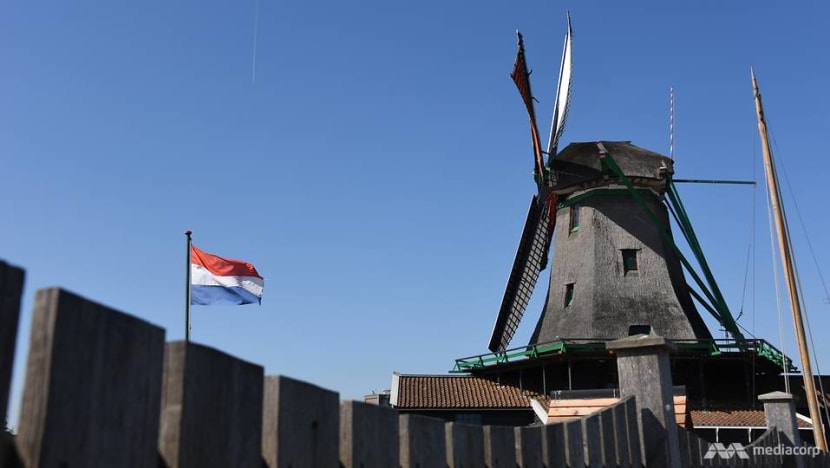
By the 15th century, the now-iconic windmills were built to help drive water pumps, making polder-draining much more efficient and reclaiming larger swamps and lakes possible.
Steam-driven pumping stations arrived at the end of the 18th century, followed later by diesel and electricity-run ones.
These days, almost all pumping stations in the Netherlands are driven by electricity.
According to figures from the Union of Water Boards, there were 3,700 water pumping stations across the Netherlands in 2018.
3. WHAT ARE POLDERS USED FOR?
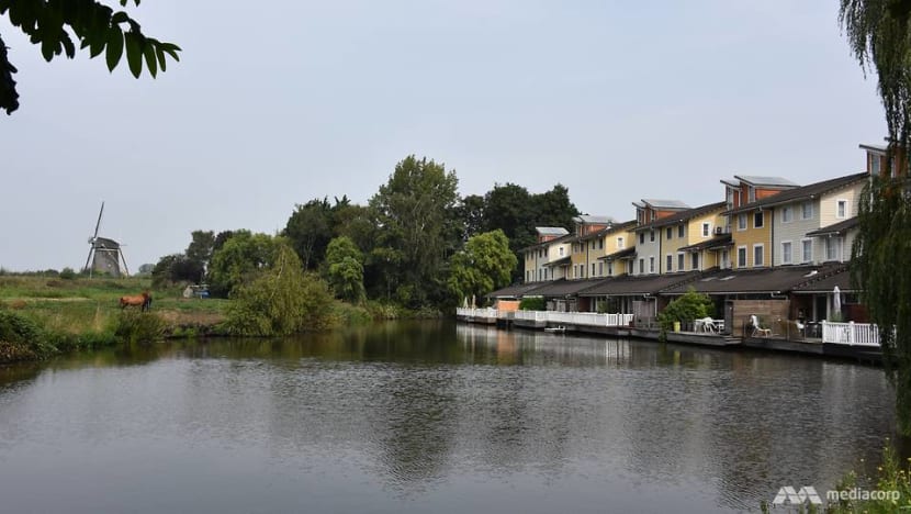
Agriculture remains a common use, as seen by vast fields dotted by farmhouses and grazing cows, as well as canals and the occasional windmill.
Polders are also used for other purposes in the Netherlands, including providing land for residential, commercial, industrial and military needs.
Amsterdam’s Schiphol Airport is built on polder land, which was created by the draining of the Haarlemmer Lake in 1852.
“Technically, the airport lies on the bottom of the lake, over four metres below sea level … making Schiphol one of the world's most low-lying airports,” according to its website.
4. WHAT ARE THE PROS AND CONS?
Experts said the Dutch model of polders uses less sand compared with regular reclamation, which heightens the land above sea level.
However polders will require constant pumping to be kept dry, while dykes have to be maintained regularly.
“There is a larger flood risk due to precipitation or dyke breaches,” said Assoc Prof van der Wegen. “On the other hand, high reclaimed land has less flooding risk and may be cheaper in maintenance (as it requires) no pumping”.
Echoing that, Mr van Zanten said: “Construction costs are higher for land reclamation but the annual costs after that are much lower.
“But for a polder, operations and maintenance of the system, like the pumps, are important so the annual costs are higher though initial costs are lower.”
Highlighting another consideration in the area of energy consumption, Mr Nauta said: “From windmills to steam engines and now, pumping machines, we keep on pumping to keep the Netherlands dry.
“If an energy crisis hits us, it will hit us badly.”
The Netherlands is also facing the problem of land subsidence – shrinking and consolidation of land – especially in the country’s peat-rich land areas.
“If you pump out water, the peat oxidises and becomes smaller. That means the land goes down,” explained Mr Nauta. “Peat and polders are unfortunately not the best combination.”
READ: Tides of change - Palau calls on ‘big brothers and sisters’ in the global effort against climate change
READ: Tides of change - As fish and coral disappear, Palau faces the economic realities of climate change
Climate change has also appeared to play a role in accelerating subsidence, with relatively warm summers dehydrating peat soils and speeding up land shrinkage.
“There are other sources of subsidence in the Netherlands but the most severe part is in the western part on the peat lands. If you keep on pumping from these polder areas, the polder gets deeper and deeper.
“So our ground is going down and the sea level is going up, which means we have to pump more and more water out – how long can you do this? That is the question,” said the Deltares expert.
READ: Tides of change - Rising sea levels threaten homes on pristine paradise of Palau
READ: Engineering solutions to tackle rising sea levels important but more research vital: Experts
5. HOW DOES IT APPLY TO SINGAPORE?
“Carefully engineered reclamations and flood defences including polders” could be the “best option” for Singapore, Associate Professor Adam Switzer of Nanyang Technological University's Earth Observatory of Singapore (EOS), told CNA last month.
“Land reclamation has a long history in Singapore and no doubt more reclamations will be needed in the future as Singapore grows,” he added.
But polders require energy and continued upkeep to drive extensive pumping systems, added Dr Switzer. “All options need to be considered.”
Additional reporting by Matthew Mohan.


