Singapore Land Authority unveils plans to deepen geospatial capabilities, including building talent pipeline
SLA, as the national geospatial agency, has been driving the adoption of geospatial data, services and technologies.

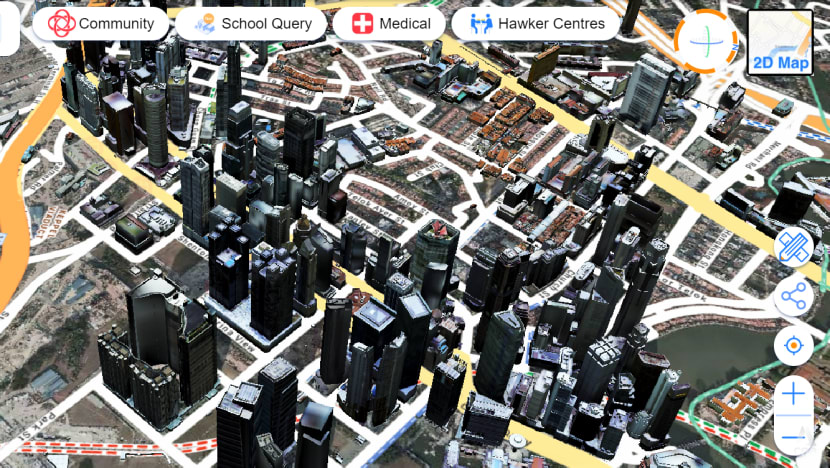
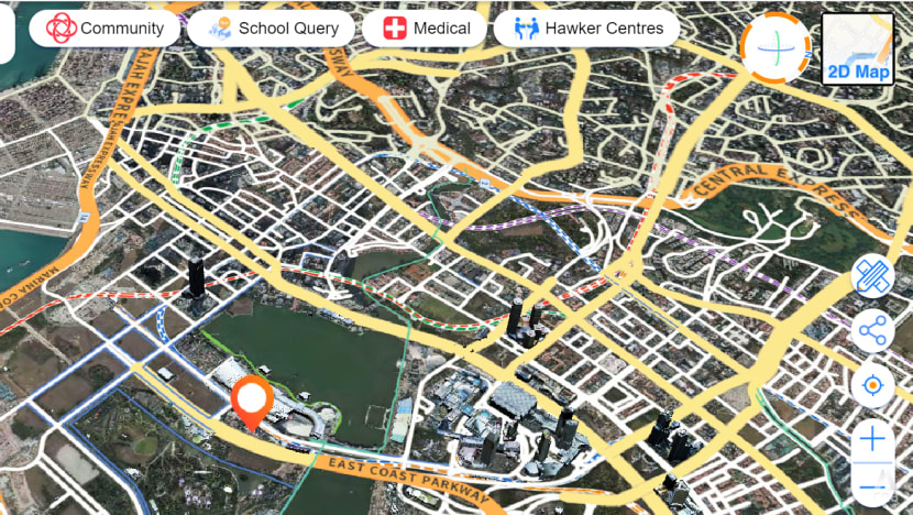
At the Singapore Geospatial Festival 2023, the Singapore Land Authority (SLA) unveiled new engagement plans, including an upcoming challenge that will see organisations and professionals harness artificial intelligence (AI) and develop innovations to enhance the country's data-driven national map, known as OneMap.
SINGAPORE: Singapore is making several moves to deepen its geospatial capabilities, including getting people to adopt geospatial technology and information in their day-to-day activities.
Geospatial information is already used quite prevalently today, but more can be done, experts told CNA’s Singapore Tonight on Tuesday (Sep 26).
“When you move from place to place, when you drive, you do use the GPS (Global Positioning System). When you want to look for restaurants and so on, you look at a map and you search for places,” said Mr Sin Lye Chong from the Singapore Land Authority (SLA), the national geospatial agency.
“But we believe that there's a lot more to geospatial capabilities than these areas.”
Mr Sin, the assistant chief executive of geospatial and engagement at SLA, pointed out that the teaching of subjects is made more interesting using geospatial data.
This is done not just in geography but also in other subjects such as social studies and history, “where we use story maps to tell stories about locations in Singapore, (and) how they have evolved over the years”, he added.
MAKING GEOSPATIAL CAPABILITIES MAINSTREAM
Geospatial refers to data that is linked to specific geographical locations.
“It is essentially location data. Data that has a georeference, so it can be located somewhere in space,” said Professor David Taylor, head of the Department of Geography at the National University of Singapore (NUS).
“But it's also more than simply locational data, because it's also the technologies that we have to visualise those data, (and) to analyse and evaluate those data.”
At the ongoing Singapore Geospatial Festival 2023, SLA unveiled new engagement plans, including an upcoming challenge that will see organisations and professionals harness artificial intelligence (AI) and develop innovations to enhance the country's data-driven national map, known as OneMap.
The annual event, held from Tuesday to Friday, brings the global geospatial community together for activities promoting the innovative use of such information and technology.
This year, the theme of the festival is “Enriching Minds, Empowering Lives”.
Mr Sin said the aim is to make the use of geospatial data and capabilities accessible to the layman.
“We don't want geospatial data and technologies to be only used by experts and scientists, we want it to be used mainstream,” he added.
“That means to be used by everyday laymen to solve the problems that we face every day.”

COMING UP WITH INNOVATIVE SOLUTIONS
SLA will be launching a OneMap GPT challenge next month to engage professionals and organisations to tap AI technologies and design principles to come up with innovations on OneMap. These solutions will combine diverse data sets from government and private sectors and present them in an easily digestible format.
Participants will develop creative location-based solutions that incorporate generative pre-trained transformers (GPT), a type of AI language model, and OneMap data to help users for various purposes, from daily tasks to significant life decisions.
“Basically GPT today is used very widely, for people to find all kinds of information, even writing speeches and so on,” said Mr Sin, adding that the aim is to partner companies at the forefront of AI technologies to come up with new ideas.
“So we want to harness this new technology for OneMap, to provide innovative solutions that can basically produce map-based information that is versatile, that is personalised for our users.”
SLA has been driving the adoption of geospatial data, services and technologies. It aims to build a collaborative environment among public agencies, private enterprises and the community.
On competing with commercial map providers including tech giant Google, Mr Sin said OneMap caters primarily to Singapore residents.
“We are the source of authoritative, government data, and we provide information and services that are uniquely Singaporean,” he added.
Mr Sin cited examples of how dengue hotspots and locations for ART test kit collections during the COVID-19 pandemic are marked out on OneMap. The app also shows the no-fly zones for drones.
“This information is on OneMap, but you won't be able to find it on commercial maps,” he said.
KEEPING PACE WITH CHANGES
Meanwhile, SLA has signed a Memorandum of Understanding with NUS to develop and promote new geospatial courses for adult learners and mid-career workers.
On the move to plug a manpower gap, Prof Taylor said geospatial is a rapidly changing field.
“AI is used, the cloud is used. These are all technologies which are changing very quickly,” he noted.
“There's also a real need to keep pace with those changes, to anticipate those changes, and even to try and get ahead of those changes as well.”
Prof Taylor said the new courses are an attempt to address a shortage in talent, and “make sure that we futureproof the talent that we have, by providing them with the opportunities to train to the highest levels possible”.
“I think we also need to be aware, of course, that there is a big digital divide,” he added.
“And so there are still people who don't have access to geospatial data and indeed other forms of digital data. So we're also trying to address that challenge as well.”
Prof Taylor believes geospatial technologies will continue to be even more prevalent in the future.
“It's in just about every profession already. And looking into the future, that trend of increasing penetration to professions is going to continue,” he added.
“It's a question whether people can afford not to be familiar with geospatial technologies.”


