How authorities in tourist hotspots keep people safe near volcanoes
Scientists can generally tell when a volcano is in unrest, but they cannot pinpoint when exactly it will erupt, say experts at the Earth Observatory of Singapore.

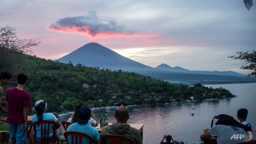
A tourist poses in front of Mount Agung at Amed beach in Karangasem on Indonesia's resort island of Bali on Nov 30, 2017. (Photo: AFP/JUNI KRISWANTO)


SINGAPORE: Some active volcanoes are also popular tourist attractions. Mount Fuji in Japan and Mount Bromo in Indonesia are just two of them.
Having a robust warning and monitoring system in place is a key plank for keeping people safe around these volcanoes given that about 500 of them have erupted in the past, according to the US Geological Survey. Most recently - the White Island volcano in New Zealand.
While the White Island eruption was not altogether unexpected, as the country’s authorities had raised alert levels before the eruption, experts said warning systems were not triggered due to its lack of lava flows.
READ: Questions mount over tours to deadly New Zealand volcano
READ: Volcano disaster puts spotlight on New Zealand adventure tourism
Here is how some countries use these monitoring systems to keep locals and visitors safe.
INDONESIA'S MOUNT AGUNG, BROMO
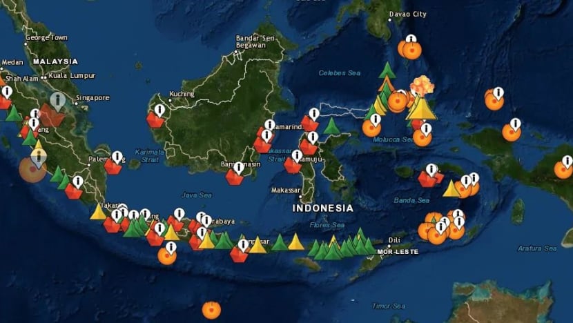
The Indonesian archipelago is part of the Pacific Ring Of Fire, and home to 127 active volcanoes.
Some of them, including Mount Bromo in East Java and Bali’s Mount Agung, are popular with both local and international tourists.
READ: Disasters rock Indonesia's '10 New Balis' tourism push
READ: Indonesia hunts for survivors as volcano tsunami toll nears 400
About half of the active volcanoes are monitored round the clock by Indonesia's Centre for Volcanology and Geological Hazard Mitigation.
Scientists from the Volcano Group at Nanyang Technological University's Earth Observatory of Singapore (EOS) told CNA that monitoring agencies commonly measure earthquake activity, ground deformations and gases emitted by the volcano for any "unrest" or changes.
Together with visual monitoring, the data is then used to "attribute a volcanic alert level which reflects the current state of activity" - which tourists should pay attention to, said the scientists.
In Indonesia, a volcano will be assigned one of four alert levels which can be checked on the MAGMA website and app. Non-Bahasa Indonesia speakers can use the Google translation function to switch the language to English.
During the Mount Agung eruption in 2017, advisories were also provided in English at critical times, according to scientific journal Nature Research.
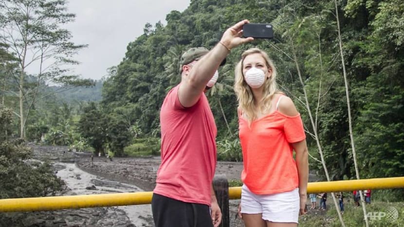
That year the volcano spewed ash as high as 9,100 metres, prompting 443 flights to be cancelled affecting more than 120,000 passengers. About 140,000 people were also evacuated from nearby villages.
READ: Once tremors detected, Bali volcano can erupt within hours - volcanologist
The volcano has continued spewing ash and smoke puffs and its threat status has remained at level 3.
"Visitors of a volcano ... should be prepared for a potential eruption which can happen at any volcanic alert level," said the EOS.
"Although scientists can generally say when a volcano is in unrest, they cannot generally forecast the exact timing of a volcanic eruption."
The scientists added: "Also, even if an eruption is more likely when the volcano is in unrest, an eruption can happen anytime."
ICELAND’S EYJAFJALLAJÖKULL: AIRSPACE DISASTER
Iceland is increasingly popular with Singaporeans seeking a taste of adventure - like chasing the northern lights and scaling glaciers.
READ: Walking tours - More Singaporeans are stepping up to this hot vacation trend
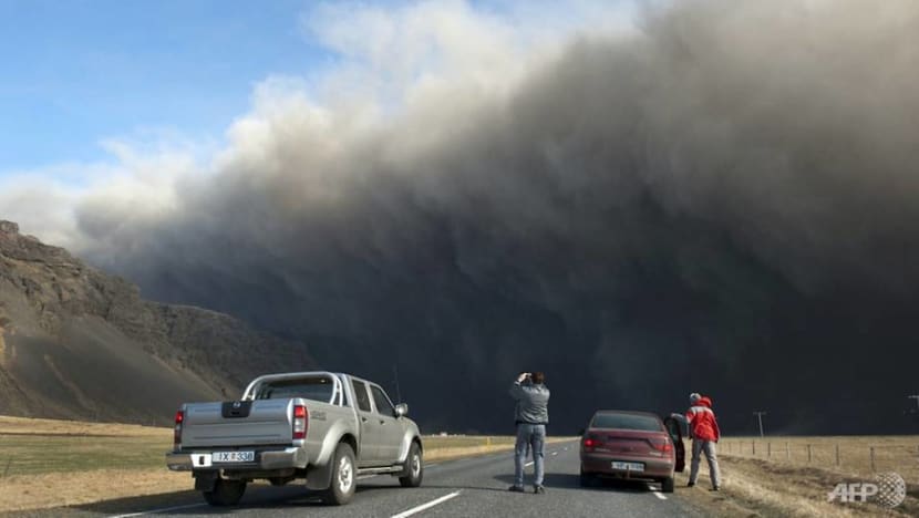
The island-nation experienced a tourism boom, ironically, after the Eyjafjallajökull (pronounced AY-uh-fyat-luh-YOE-kuutl) volcano erupted in 2010, spewing so much ash and dust, causing the biggest shutdown of European airspace since World War II.

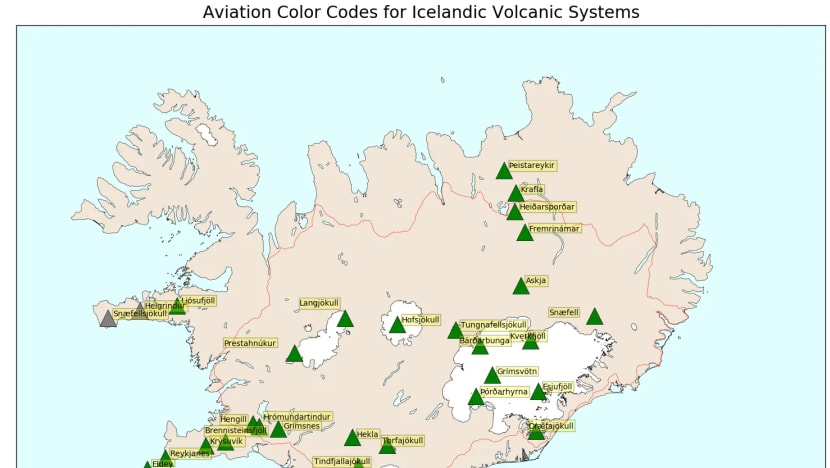
Daily updates on volcanic activities are provided on the Icelandic Meteorological Office website.
It uses the International Civil Aviation Organisation's colour-coded classification, which ranges from green (normal activity) to red (imminent eruption).
Efforts to predict eruptions are made complicated by differences in each volcano, according to the EOS.
"Monitoring strategies therefore need to be tailored to each volcano and monitoring techniques are continuously being developed," the scientists said.
In the case of a moderately active volcano like Eyjafjallajökull, for example, the "unrest" that immediately preceded the eruption was “subtle and difficult to detect”, unlike in highly active volcanoes, said Freysteinn Sigmundsson of the Nordic Volcanological Centre at the University of Iceland.
ITALY’S MOUNT ETNA: A BREAKTHROUGH?
Much further south in Sicily, scientists have created the world’s first automated volcanic eruption forecasting tool for Mount Etna, Europe's largest active volcano.
It works by detecting sound waves created by the movement of gas, which signifies an eruption is about to happen.
Before an eruption, gas would rise out of the magma, causing the air in the volcano’s crater to slosh back and forth - creating sound waves like those from a woodwind instrument - the Nature Research report explained.
Since its creation in 2010, the system successfully predicted 57 out of 59 eruptions in the following eight years, according to a study in the Journal Of Geophysical Research: Solid Earth.
In 2015, the system gave the Italian authorities a one hour window allowing them to activate emergency plans ahead of the eruption.
This early-warning system is now being tested in Iceland.
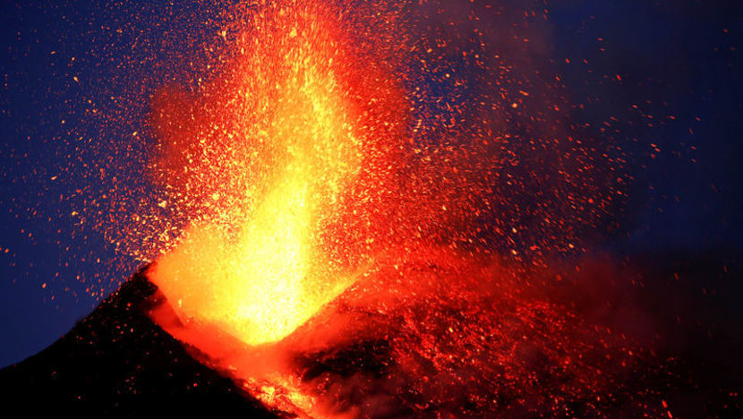
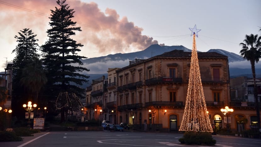
Mount Etna last erupted on Christmas Eve last year, prompting a partial closure of Sicilian airspace.
“You’re covering a lot of ground really fast, so if there is an ash cloud that has suddenly popped up, then the pilots need to know that information as soon as possible,” said John Lyons, a geophysicist at the Alaska Volcano Observatory, as quoted by Nature Research.
“Every minute counts.”
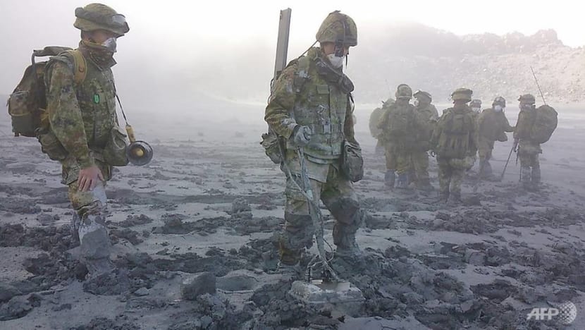
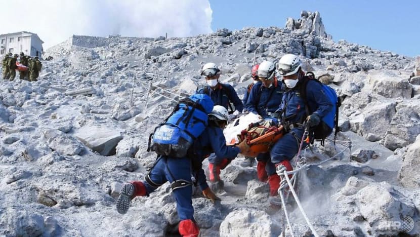
JAPAN’S MOUNT ONTAKE: WHEN J-ALERT WAS SILENT
Being caught off-guard by an eruption can indeed be fatal, as seen in White Island, as well as the eruption in 2014 of Japan’s Mount Ontake.
As in White Island’s, this steam-driven eruption occurred without clear warning, killing 63 hikers - Japan's highest toll for an eruption in 90 years.
Commentary: Why were tourists allowed to visit New Zealand's White Island volcano?
Such an eruption occurs as magma that is rising within the volcano begins to heat up water in the chamber, according to the EOS.
"This leads to a pressure increase (a bit like in a pressure cooker) and a potential eruption," the scientists said.
The eruption took experts by surprise even as 47 out of Japan's 110 active volcanoes are constantly monitored, according to Nature Research.
Unpredictable eruptions may happen for different reasons, said the EOS.
"For example, if there is no or little pressure build-up (due to an open vent), the warning signals might be too small to be recorded," said the scientists, adding that the authorities' monitoring strategy determines "whether they send the information in real-time and the type of data analyses" that can be performed.
"Signs of an eruption are often seen after the eruption happened, following complex analyses that cannot be implemented in real-time."
Disaster-prone Japan operates a highly sophisticated system to disseminate alerts - dubbed J-Alert - through various media, including TV, radio, the Internet and loudspeaker vans. Foreigners can even receive J-Alert updates in English through an app created by public broadcaster NHK World.

In spite of this, no alarm was sounded prior to Ontake’s eruption.
Adventurers wishing to trek Japan’s slopes, including Mount Fuji, should bear in mind that while the risk of being caught in an eruption is small, it “is nonetheless a real one”, The Japan Times warned.
“When climbing up or near volcanoes, always pay close attention to official warnings, signs and announcements. Carry a flashlight, and if possible, eye goggles and a small radio,” advised the Japan Meteorological Agency.
“Always be aware of your surroundings and know your escape route if there were to be an eruption. If you are in the immediate vicinity of an eruption, leave immediately and seek cover.
“Avoid gullies, rivers or anywhere downstream of the eruption. Look out for flying rocks and ash, and use a mask, bandana or damp cloth to cover your nose and mouth.”