


New MRT map launched with Circle Line as focal point
A new and refreshed MRT system map was launched on Wednesday (Dec 11), featuring the Circle Line as a focal point and some of Singapore's most distinct landmarks.

The Singapore MRT system map has been changed to show the Circle Line as a focal point. (Image: LTA)
SINGAPORE: A new and refreshed MRT system map was launched on Wednesday (Dec 11), featuring the Circle Line as a focal point and some of Singapore's most distinct landmarks.
“When viewing the new map, the Circle Line will intuitively serve as a focal point to help commuters quickly orientate themselves and plan their journeys,” said the Land Transport Authority (LTA).
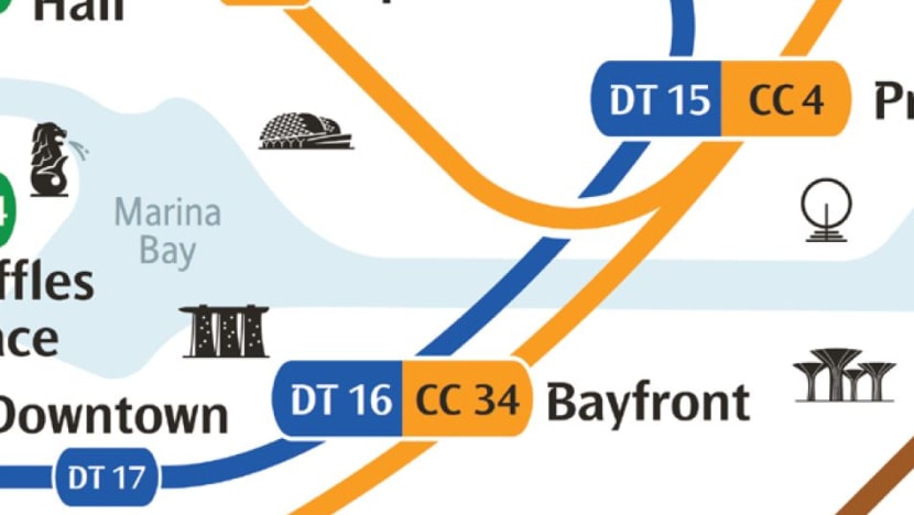
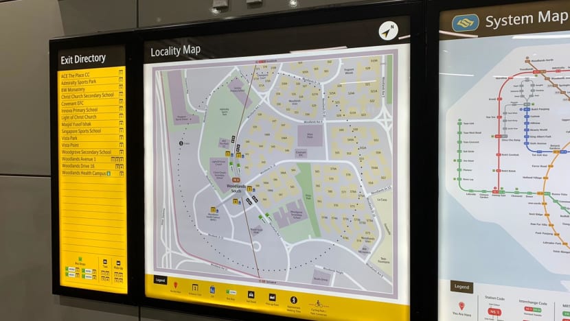
For the first time, the MRT map includes prominent landmarks and water bodies so that commuters can identify their corresponding stations. Stickers pointing out the current station will make journey planning faster. Quick response (QR) codes on the maps link users to an online fare calculator and downloadable maps in Singapore's four official languages for offline viewing.
Read:
The process of redesigning the map started in 2015, LTA said. It sought feedback from members of the public and tested prototypes with map designers at international forums.
LTA also worked with a research lab at the Nanyang Technological University to see how current signs at MRT stations can be improved.
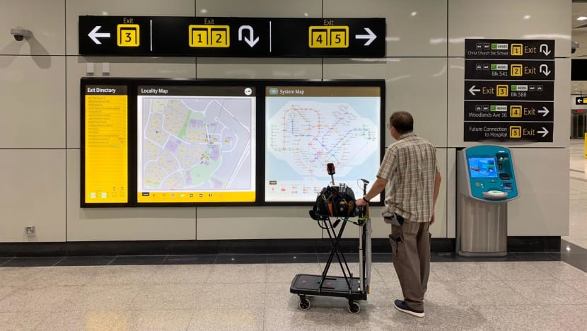
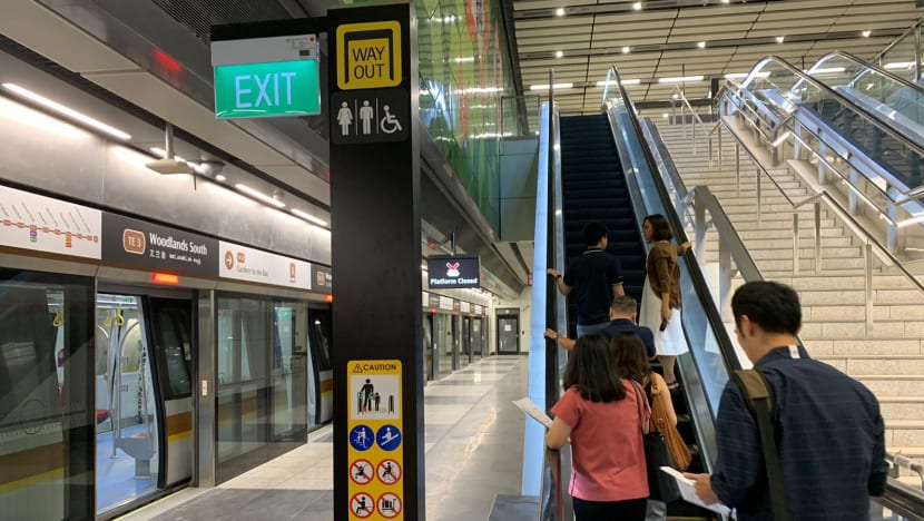
Along with the new map, transit signage at MRT stations - starting with the new Thomson-East Coast Line - will be improved with a larger font, new icons, sharper colour contrast and a new design.
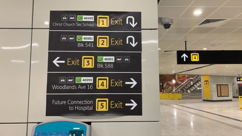
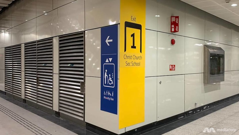
For example, all exit signs will be in yellow to make them more prominent. They will also be labelled in numbers instead of letters, and feature bus stop numbers for easier route connections.
Directional signs will be redesigned to have fewer words and bigger icons. The icon for toilets has been redesigned to make it more distinguishable, after some confusion with the icon for lifts.
The exit directory at train stations will include amenities like bus stops, while maps of the surrounding area will be improved and include a new "walking radius" of five to seven minutes to indicate the distance to nearby landmarks.
Exits and lifts will also be fitted with large signs so commuters can spot them from a distance after going up the escalators.
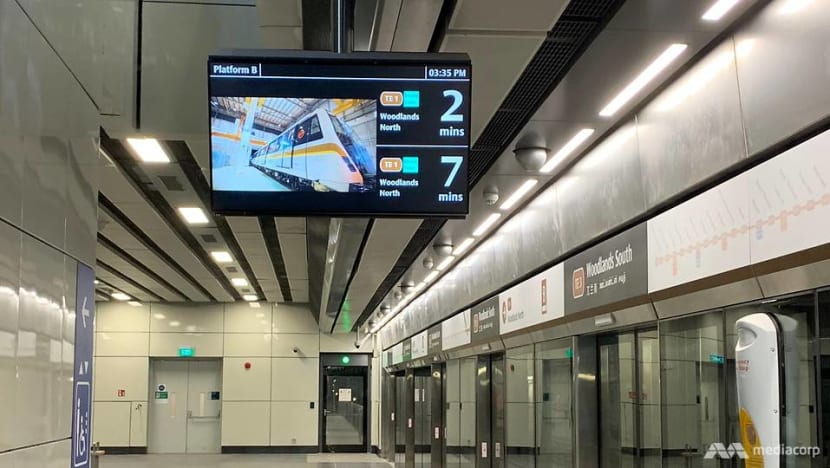
There will now be two screens instead of one at station platforms and the next train's estimated arrival time will stay on the screens during advertisements.
Lifts will be fitted with priority signs to encourage gracious behaviour.
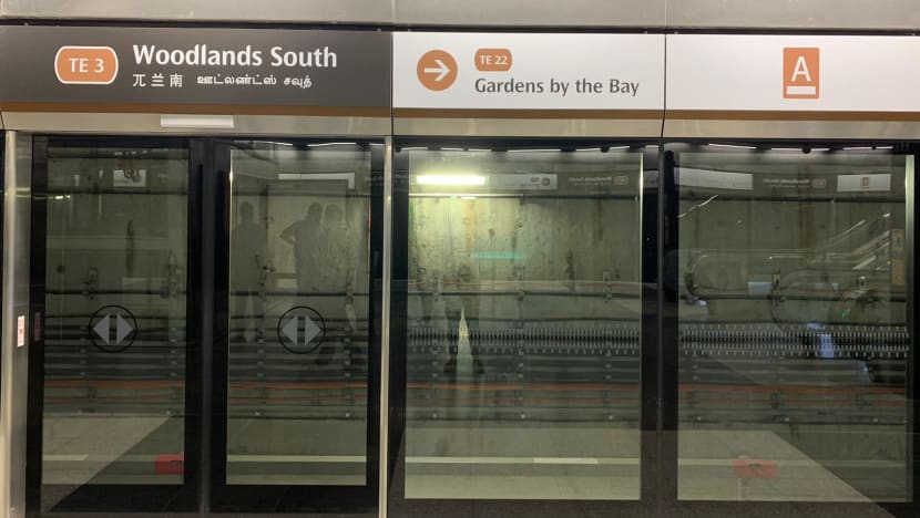
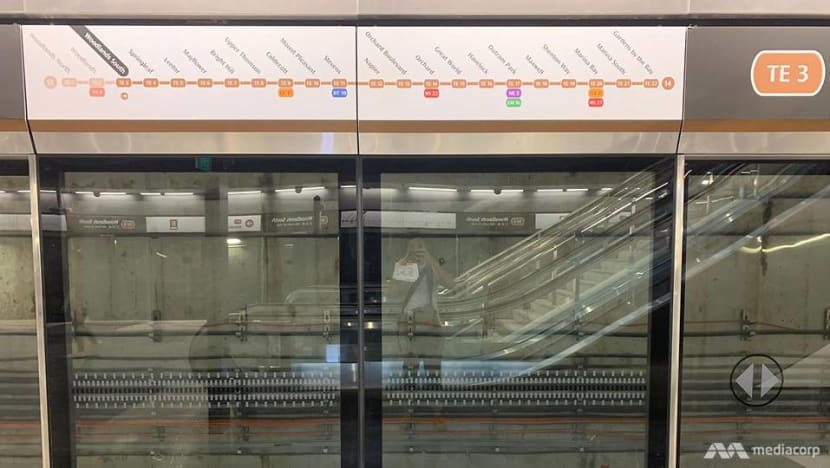
Signs showing the station name will also display the train's direction and a full list of stations on the line, compared to the current partial snapshot.
The redesign of the map comes as new rail lines are added to Singapore's transport network, LTA said. The old map features a more linear design that might not be suitable as the network becomes more complex.
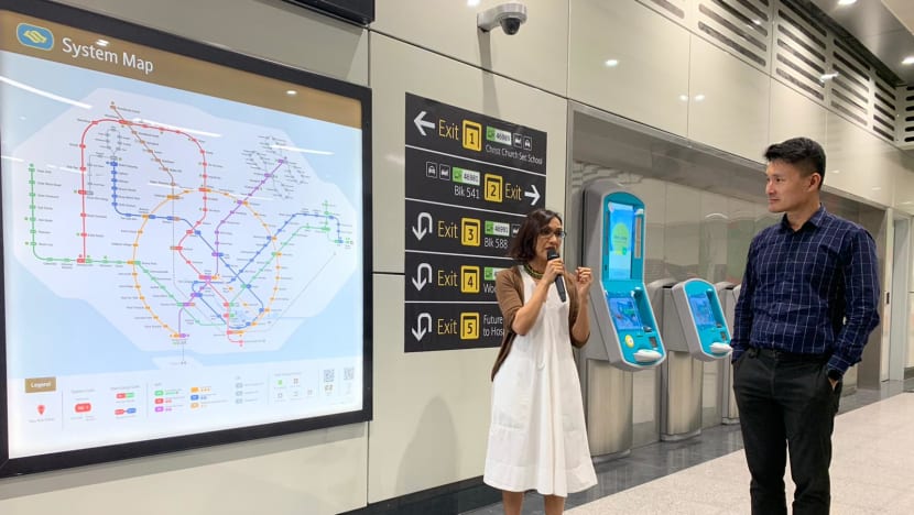
Senior Parliamentary Secretary for Transport Baey Yam Keng said the opening of the new Thomson-East Coast Line (TEL) gave LTA the opportunity to improve station signage and revamp the MRT map.
"With an ageing population, we also want to encourage the elderly to make use of the train," he told reporters at Woodlands South station.
"Larger font size, clearer symbols - all these make wayfinding a lot easier and convenient for commuters."
Mr Baey said the new map strengthens the "relativity" between the different MRT lines and makes it easier for commuters to find their way to various destinations.
"I'm glad to see that the LTA team, with inputs from the public and experts, have put in a lot effort to improve the system map," he added.
The map has been installed at the three new stations and commuters can expect to see it at all MRT and LRT stations from January next year.
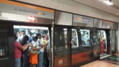
The first stretch of the TEL is expected to open by Jan 31 next year, comprising three stations in the north of Singapore – Woodlands North, Woodlands and Woodlands South.
The new signs have been installed at the three new stations and LTA will consider commuter feedback before expanding them to other stations.
Mr Baey later said the "real test" will come from public feedback, when the three new stations open and commuters start flooding in.
"My LTA colleagues have done a lot of background work to make sure that what we put up is based on careful thinking and planning," he added.
"Because sometimes when the crowds are there ... different types of commuters may have different needs and different ways of responding to the new signage.
"So (LTA) is open to more feedback to fine-tune the system map and other signage so that we can allow more commuters to benefit."


